
Beelsby topographic map
Interactive map
Click on the map to display elevation.
About this map
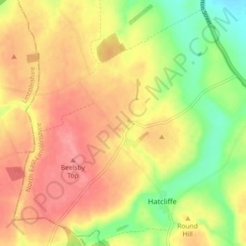
Name: Beelsby topographic map, elevation, terrain.
Location: Beelsby, North East Lincolnshire, England, United Kingdom (53.48375 -0.21060 53.51850 -0.14753)
Average elevation: 63 m
Minimum elevation: 18 m
Maximum elevation: 97 m
North East Lincolnshire trails, hiking, mountain biking, running and outdoor activities
Other topographic maps
Click on a map to view its topography, its elevation and its terrain.