
Onna topographic map
Interactive map
Click on the map to display elevation.
About this map
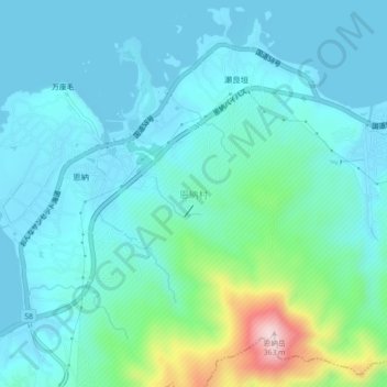
Name: Onna topographic map, elevation, terrain.
Location: Onna, Kunigami, Okinawa Prefecture, 904-0411, Japan (26.47389 127.84537 26.51389 127.88537)
Average elevation: 60 m
Minimum elevation: 0 m
Maximum elevation: 353 m