
Lake Ariel topographic map
Interactive map
Click on the map to display elevation.
About this map
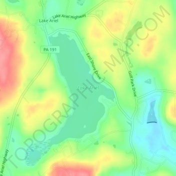
Name: Lake Ariel topographic map, elevation, terrain.
Average elevation: 451 m
Minimum elevation: 415 m
Maximum elevation: 499 m
Other topographic maps
Click on a map to view its topography, its elevation and its terrain.
Lake Ariel
United States > Pennsylvania > Wayne County > Lake Ariel
Lake Ariel, Lake Township, Wayne County, Pennsylvania, 18427, United States
Average elevation: 453 m