
Gemeinde Biberwier topographic map
Interactive map
Click on the map to display elevation.
About this map
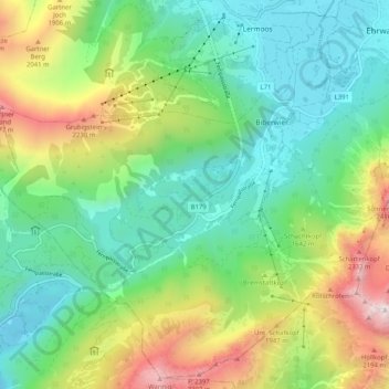
Name: Gemeinde Biberwier topographic map, elevation, terrain.
Location: Gemeinde Biberwier, Bezirk Reutte, Tyrol, 6633, Austria (47.33685 10.81979 47.40188 10.92191)
Average elevation: 1,479 m
Minimum elevation: 933 m
Maximum elevation: 2,652 m
Other topographic maps
Click on a map to view its topography, its elevation and its terrain.
Gemeinde Bach
Austria > Tyrol > Bezirk Reutte
Gemeinde Bach, Bezirk Reutte, Tyrol, 6653, Austria
Average elevation: 1,784 m
Jungholz
Austria > Tyrol > Bezirk Reutte > Jungholz
Jungholz, Bezirk Reutte, Tyrol, 6691, Austria
Average elevation: 1,139 m