
Gemeinde Bach topographic map
Interactive map
Click on the map to display elevation.
About this map
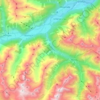
Name: Gemeinde Bach topographic map, elevation, terrain.
Location: Gemeinde Bach, Bezirk Reutte, Tyrol, 6653, Austria (47.19654 10.33429 47.29153 10.49473)
Average elevation: 1,784 m
Minimum elevation: 1,009 m
Maximum elevation: 2,830 m
Other topographic maps
Click on a map to view its topography, its elevation and its terrain.
Gemeinde Biberwier
Austria > Tyrol > Bezirk Reutte
Gemeinde Biberwier, Bezirk Reutte, Tyrol, 6633, Austria
Average elevation: 1,479 m
Jungholz
Austria > Tyrol > Bezirk Reutte > Jungholz
Jungholz, Bezirk Reutte, Tyrol, 6691, Austria
Average elevation: 1,139 m