
Make a donation
Gear up for your next adventure:
As an Amazon Associate, this site earns from qualifying purchases at no extra cost to you.
Erer topographic map
Click on the map to display elevation.
Make a donation
Gear up for your next adventure:
As an Amazon Associate, this site earns from qualifying purchases at no extra cost to you.
About this map
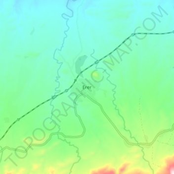
Name: Erer topographic map, elevation, terrain.
Location: Erer, Siti, Somali Region, Ethiopia (9.51724 41.34540 9.59724 41.42540)
Average elevation: 1,111 m
Minimum elevation: 1,009 m
Maximum elevation: 1,451 m
Make a donation
Gear up for your next adventure:
As an Amazon Associate, this site earns from qualifying purchases at no extra cost to you.
Other topographic maps
Click on a map to view its topography, its elevation and its terrain.
Shabelle
Grazing land for pastoralists make up the majority of Shabelle Zone. Six of its seven woredas are located along the banks of the Shebelle river, which flows out of the highlands through the Zone and into Somalia. 40-50% of the population depend on irrigated farming, 25-30% on agro-pastoralism and 20-30% on…
Average elevation: 569 m
Make a donation
Gear up for your next adventure:
As an Amazon Associate, this site earns from qualifying purchases at no extra cost to you.