
Kanchiyar topographic map
Interactive map
Click on the map to display elevation.
About this map
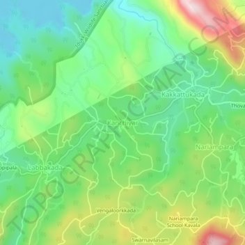
Name: Kanchiyar topographic map, elevation, terrain.
Location: Kanchiyar, Idukki, Idukki District, Kerala, 685511, India (9.72530 77.05533 9.76530 77.09533)
Average elevation: 868 m
Minimum elevation: 714 m
Maximum elevation: 1,153 m
Other topographic maps
Click on a map to view its topography, its elevation and its terrain.