
arrondissement de Tanger-Medina طنجة المدينة topographic map
Interactive map
Click on the map to display elevation.
About this map
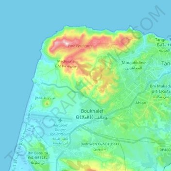
Name: arrondissement de Tanger-Medina طنجة المدينة topographic map, elevation, terrain.
Average elevation: 49 m
Minimum elevation: -5 m
Maximum elevation: 317 m
Other topographic maps
Click on a map to view its topography, its elevation and its terrain.