
Harbutowice topographic map
Interactive map
Click on the map to display elevation.
About this map
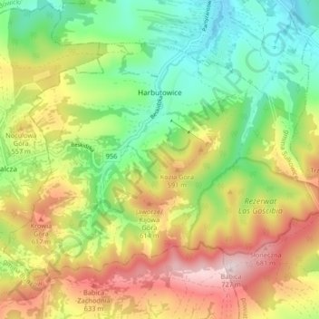
Name: Harbutowice topographic map, elevation, terrain.
Average elevation: 483 m
Minimum elevation: 307 m
Maximum elevation: 721 m
Other topographic maps
Click on a map to view its topography, its elevation and its terrain.
Lake Dobczyce
Poland > Lesser Poland Voivodeship > Myślenice County > Brzączowice
Average elevation: 301 m
Myślenice
Poland > Lesser Poland Voivodeship > Myślenice County > Myślenice > Myślenice
Average elevation: 374 m