Geolocate

Punitaqui topographic map

Click on the map to display elevation.

About this map
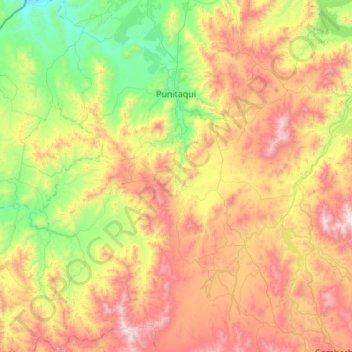
Name: Punitaqui topographic map, elevation, terrain.

Location: Punitaqui, Provincia de Limarí, Coquimbo Region, Chile (-31.17652 -71.55138 -30.70893 -71.01897)

Average elevation: 656 m

Minimum elevation: 58 m

Maximum elevation: 1,537 m

Other topographic maps

Click on a map to view its topography, its elevation and its terrain.

Sotaquí

Chile > Coquimbo Region > Provincia de Limarí > Ovalle

Average elevation: 318 m

Gear up for your next adventure:

🧦Merino Wool Hiking Socks - Moisture-wicking socks to prevent blisters during long mountain walks
👟Women's Trail Running Shoes - Agile footwear for fell running and technical trails
🧣Neck Gaiters - Protects against wind and sun on exposed ridges and peaks
🧭Professional Hiking Compasses - High-precision liquid-filled compasses for map reading and orientation
🔋Solar Power Banks - Keep your GPS and phone charged during multi-day expeditions

As an Amazon Associate, this site earns from qualifying purchases at no extra cost to you.