
Ulamış Mahallesi topographic map
Interactive map
Click on the map to display elevation.
About this map
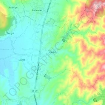
Name: Ulamış Mahallesi topographic map, elevation, terrain.
Location: Ulamış Mahallesi, Seferihisar, Izmir, Aegean Region, Turkey (38.22355 26.80799 38.26878 26.89448)
Average elevation: 116 m
Minimum elevation: 16 m
Maximum elevation: 360 m