
Earl Stonham topographic map
Interactive map
Click on the map to display elevation.
About this map
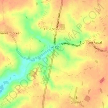
Name: Earl Stonham topographic map, elevation, terrain.
Average elevation: 55 m
Minimum elevation: 27 m
Maximum elevation: 70 m
Suffolk trails, hiking, mountain biking, running and outdoor activities
Other topographic maps
Click on a map to view its topography, its elevation and its terrain.
Creeting St. Peter or West Creeting
United Kingdom > England > Suffolk > Mid Suffolk
Average elevation: 44 m