Geolocate

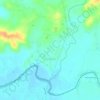
Dasol topographic map

Click on the map to display elevation.

About this map

Name: Dasol topographic map, elevation, terrain.

Location: Dasol, Pangasinan, Ilocos Region, 2411, Philippines (15.95023 119.84114 16.03023 119.92114)

Average elevation: 34 m

Minimum elevation: -1 m

Maximum elevation: 166 m

Other topographic maps

Click on a map to view its topography, its elevation and its terrain.

Alcala

Philippines > Pangasinan

Average elevation: 20 m

Alaminos

Philippines > Pangasinan

Average elevation: 34 m

Tanaytay

Philippines > Pangasinan > Alaminos

Average elevation: 12 m

Santiago Island

Philippines > Pangasinan > Bolinao

Average elevation: 9 m

Tangcarang

Philippines > Pangasinan > Alaminos

Average elevation: 23 m

Lucap

Philippines > Pangasinan > Alaminos

Average elevation: 9 m

Nangalisan

Philippines > Pangasinan > Infanta

Average elevation: 15 m

Binmaley

Philippines > Pangasinan

Average elevation: 5 m

Gear up for your next adventure:

⛺Lightweight Solo Tents - Backpacking tents designed for wild camping in the UK highlands
📱Rugged Phone Cases - Heavy-duty protection for smartphones used as secondary GPS tools
🥄Titanium Camping Sporks - The ultimate lightweight utensil for trail meals
🚲Bikepacking Frame Bags - Storage for tools and navigation gear on long off-road rides
🦶Anti-Blister Balms - Protect your feet before long topographic expeditions

As an Amazon Associate, this site earns from qualifying purchases at no extra cost to you.