Geolocate

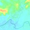
Dasol topographic map

Click on the map to display elevation.

About this map

Name: Dasol topographic map, elevation, terrain.

Location: Dasol, Pangasinan, Ilocos Region, 2411, Philippines (15.95023 119.84114 16.03023 119.92114)

Average elevation: 34 m

Minimum elevation: -1 m

Maximum elevation: 166 m

Other topographic maps

Click on a map to view its topography, its elevation and its terrain.

Alcala

Philippines > Pangasinan

Average elevation: 20 m

Alaminos

Philippines > Pangasinan

Average elevation: 34 m

Tanaytay

Philippines > Pangasinan > Alaminos

Average elevation: 12 m

Santiago Island

Philippines > Pangasinan > Bolinao

Average elevation: 9 m

Tangcarang

Philippines > Pangasinan > Alaminos

Average elevation: 23 m

Lucap

Philippines > Pangasinan > Alaminos

Average elevation: 9 m

Nangalisan

Philippines > Pangasinan > Infanta

Average elevation: 15 m

Binmaley

Philippines > Pangasinan

Average elevation: 5 m

Gear up for your next adventure:

🧴Sport Sunscreen Sticks - High-protection sunblock that won't run into your eyes on the trail
👟Women's Trail Running Shoes - Agile footwear for fell running and technical trails
🚲Cycling GPS Computers - Track elevation and topographic routes on two wheels
🔥Reusable Hand Warmers - Maintain dexterity in your fingers for precise map handling
🔥Emergency Fire Starters - Reliable ignition tools for survival situations in damp conditions

As an Amazon Associate, this site earns from qualifying purchases at no extra cost to you.