
Adekar Disctrict topographic map
Interactive map
Click on the map to display elevation.
About this map
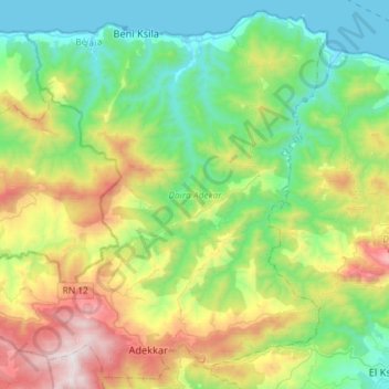
Name: Adekar Disctrict topographic map, elevation, terrain.
Location: Adekar Disctrict, Bejaia, 06000, Algeria (36.67554 4.51735 36.89594 4.80756)
Average elevation: 471 m
Minimum elevation: 0 m
Maximum elevation: 1,516 m
Other topographic maps
Click on a map to view its topography, its elevation and its terrain.
Chta
Algeria > Bejaia > Souk El-Tenine District > Souk El Tenine > Louta > Chta
Average elevation: 181 m