Mutare topographic map
Click on the map to display elevation.
Mutare
The Eastern Highlands extend north and south through eastern portion of the district, along the border with Mozambique. The Bvumba Mountains form a part of the highlands, and rise southeast of Mutare city. The highest peak is Castle Beacon at 1,911 metres. The Bunga Forest Botanical Reserve conserves the mountains' high-elevation mist forest. Banti Forest Reserve (22.2 km²) is located south of the Bvumba Range, in the mountains along the Mozambican border.
About this map
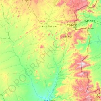
Name: Mutare topographic map, elevation, terrain.
Location: Mutare, Manicaland Province, Zimbabwe (-19.77875 32.01407 -18.71876 32.87753)
Average elevation: 995 m
Minimum elevation: 512 m
Maximum elevation: 2,266 m
Other topographic maps
Click on a map to view its topography, its elevation and its terrain.