
Ceranesi topographic map
Interactive map
Click on the map to display elevation.
About this map
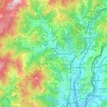
Name: Ceranesi topographic map, elevation, terrain.
Location: Ceranesi, Gênes, Ligurie, 16014, Italie (44.47252 8.79276 44.54241 8.89697)
Average elevation: 352 m
Minimum elevation: 51 m
Maximum elevation: 958 m
Other topographic maps
Click on a map to view its topography, its elevation and its terrain.
Piani di Praglia
Italie > Ligurie > Gênes > Ceranesi
Piani di Praglia, Ceranesi, Gênes, Ligurie, Italie
Average elevation: 798 m