
Grand Bassa topographic map
Interactive map
Click on the map to display elevation.
About this map
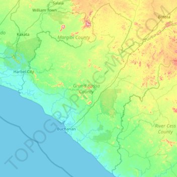
Name: Grand Bassa topographic map, elevation, terrain.
Location: Grand Bassa, Liberia (5.57244 -10.38220 6.74613 -9.15832)
Average elevation: 98 m
Minimum elevation: 0 m
Maximum elevation: 598 m
Other topographic maps
Click on a map to view its topography, its elevation and its terrain.
Zee
Liberia > Grand Bassa > District # 2
Zee, District # 2, Grand Bassa, Liberia
Average elevation: 94 m
Twe Farm
Liberia > Montserrado County > Greater Monrovia > Monrovia > Twe Farm
Twe Farm, Monrovia, Greater Monrovia, Montserrado County, Liberia
Average elevation: 6 m
Buchanan
Liberia > Grand Bassa County > Commonwealth-B > Buchanan
Buchanan, Commonwealth-B, Grand Bassa County, Liberia
Average elevation: 3 m
Ricks
Liberia > Montserrado County > Ricks
Ricks, St. Paul River, Montserrado County, Liberia
Average elevation: 12 m