
Matunda topographic map
Click on the map to display elevation.
About this map
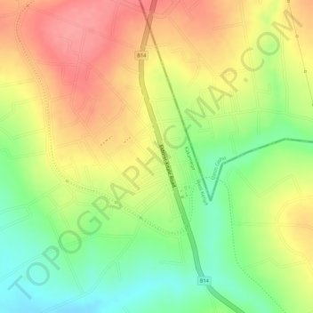
Name: Matunda topographic map, elevation, terrain.
Location: Matunda, Kakamega County, West Kenya, Kenya (0.82072 35.11812 0.83390 35.12510)
Average elevation: 1,841 m
Minimum elevation: 1,791 m
Maximum elevation: 1,881 m
Other topographic maps
Click on a map to view its topography, its elevation and its terrain.
Kakamega Forest
Kenya > Kakamega County > Shinyalu
The forest lies on undulating terrain, mostly between 1500 and 1600 meters elevation. It is in the watershed of the Isiukhu and Yala rivers, which originate on the Nandi Escarpment to the east and flow westwards through the forest before emptying into Lake Victoria.
Average elevation: 1,626 m