Geolocate

Kapaa topographic map

Click on the map to display elevation.

About this map

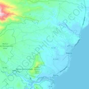
Name: Kapaa topographic map, elevation, terrain.

Location: Kapaa, Kauaʻi County, Hawaii, United States (22.05741 -159.40285 22.10936 -159.30346)

Average elevation: 96 m

Minimum elevation: -1 m

Maximum elevation: 770 m

Gear up for your next adventure:

🥾Hiking Boots - Waterproof and durable boots for long-distance hiking in the UK
🧥Packable Down Jackets - Lightweight warmth that compresses small in your bag
🥾Walking Shoes - Lightweight walking shoes for countryside and coastal paths
🔋Solar Power Banks - Keep your GPS and phone charged during multi-day expeditions
🧼Technical Clothing Wash - Special soap to clean and restore waterproof membranes

As an Amazon Associate, this site earns from qualifying purchases at no extra cost to you.