
Pulau Simeulue topographic map
Interactive map
Click on the map to display elevation.
About this map
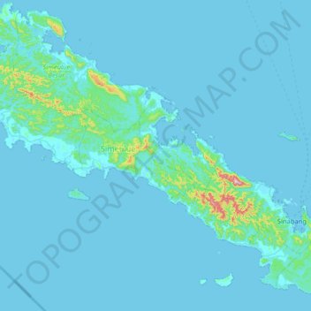
Name: Pulau Simeulue topographic map, elevation, terrain.
Location: Pulau Simeulue, Teluk Dalam, Simeulue, Aceh, Indonesia (2.29366 95.78042 2.93366 96.42042)
Average elevation: 21 m
Minimum elevation: -3 m
Maximum elevation: 545 m
Other topographic maps
Click on a map to view its topography, its elevation and its terrain.