
Mayo-Belwa topographic map
Interactive map
Click on the map to display elevation.
Mayo-Belwa
The rainy season in Mayo-Belwa is oppressive and overcast, the dry season is partly cloudy, and it is hot all year. Throughout the year, the temperature normally ranges from 61°F to 99°F, with temperatures rarely falling below 55°F or rising above 105°F. Mayo Belwa has a Tropical wet and dry or savanna climate (Classification: Aw) and is located at an elevation of None meters (0 feet) above sea level. The yearly temperature in the district is 30.37oC (86.67oF), which is 0.91% higher than the national average. Mayo Belwa gets about 113.75 millimeters (4.48 inches) of rain every year and has 136.05 wet days (37.27% of the time).
About this map
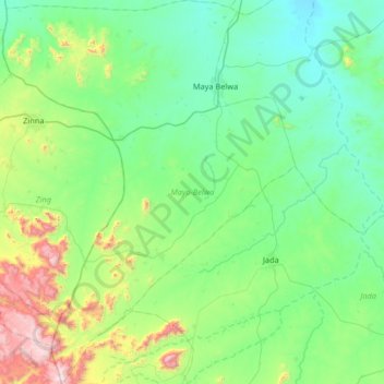
Name: Mayo-Belwa topographic map, elevation, terrain.
Location: Mayo-Belwa, Adamawa State, Nigeria (8.54623 11.69494 9.19513 12.19691)
Average elevation: 446 m
Minimum elevation: 185 m
Maximum elevation: 1,538 m
Other topographic maps
Click on a map to view its topography, its elevation and its terrain.