
Wynyard topographic map
Click on the map to display elevation.
About this map
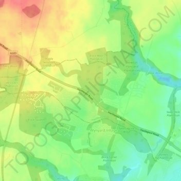
Name: Wynyard topographic map, elevation, terrain.
Location: Wynyard, Hartlepool, Tees Valley, England, United Kingdom (54.63131 -1.38375 54.65626 -1.32808)
Average elevation: 67 m
Minimum elevation: 36 m
Maximum elevation: 99 m
Hartlepool trails, hiking, mountain biking, running and outdoor activities
Other topographic maps
Click on a map to view its topography, its elevation and its terrain.