
Gries am Brenner topographic map
Interactive map
Click on the map to display elevation.
About this map
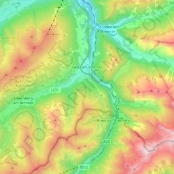
Name: Gries am Brenner topographic map, elevation, terrain.
Location: Gries am Brenner, Bezirk Innsbruck-Land, Tyrol, 6156, Austria (46.97410 11.42591 47.07624 11.58991)
Average elevation: 1,747 m
Minimum elevation: 1,067 m
Maximum elevation: 2,757 m
Other topographic maps
Click on a map to view its topography, its elevation and its terrain.
Elferspitze
Austria > Tyrol > Bezirk Innsbruck-Land > Neustift im Stubaital
Average elevation: 1,978 m
Hoher Burgstall
Austria > Tyrol > Bezirk Innsbruck-Land > Neustift im Stubaital
Average elevation: 2,142 m
Axamer Lizum
Austria > Tyrol > Bezirk Innsbruck-Land > Gemeinde Axams > Axamer Lizum
Average elevation: 1,858 m