
Oturkpo topographic map
Interactive map
Click on the map to display elevation.
About this map
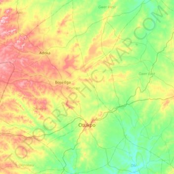
Name: Oturkpo topographic map, elevation, terrain.
Location: Oturkpo, Benue State, Nigeria (7.01258 7.86045 7.64467 8.27476)
Average elevation: 142 m
Minimum elevation: 58 m
Maximum elevation: 312 m
Other topographic maps
Click on a map to view its topography, its elevation and its terrain.