
Sattledt topographic map
Interactive map
Click on the map to display elevation.
About this map
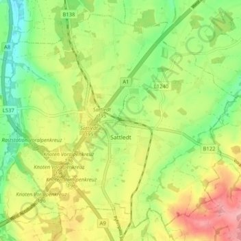
Name: Sattledt topographic map, elevation, terrain.
Location: Sattledt, Bezirk Wels-Land, Upper Austria, 4642, Austria (48.05038 14.01656 48.09738 14.09578)
Average elevation: 403 m
Minimum elevation: 350 m
Maximum elevation: 468 m
Other topographic maps
Click on a map to view its topography, its elevation and its terrain.
Au an der Traun
Austria > Upper Austria > Bezirk Wels-Land > Marchtrenk > Au an der Traun
Average elevation: 305 m