
Steinhaus topographic map
Interactive map
Click on the map to display elevation.
About this map
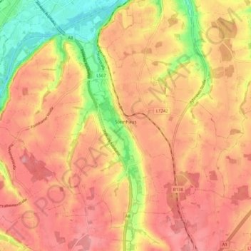
Name: Steinhaus topographic map, elevation, terrain.
Location: Steinhaus, Bezirk Wels-Land, Upper Austria, 4641, Austria (48.08700 13.96631 48.14189 14.06726)
Average elevation: 379 m
Minimum elevation: 312 m
Maximum elevation: 415 m
Other topographic maps
Click on a map to view its topography, its elevation and its terrain.
Sattledt
Austria > Upper Austria > Bezirk Wels-Land
Sattledt, Bezirk Wels-Land, Upper Austria, 4642, Austria
Average elevation: 403 m
Au an der Traun
Austria > Upper Austria > Bezirk Wels-Land > Marchtrenk > Au an der Traun
Au an der Traun, Marchtrenk, Bezirk Wels-Land, Upper Austria, 4614, Austria
Average elevation: 305 m