
Mudon Township topographic map
Interactive map
Click on the map to display elevation.
About this map
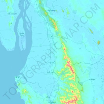
Name: Mudon Township topographic map, elevation, terrain.
Location: Mudon Township, Mawlamyine District, Mon State, Myanmar (15.96061 97.49500 16.41294 97.86752)
Average elevation: 25 m
Minimum elevation: -2 m
Maximum elevation: 599 m
Other topographic maps
Click on a map to view its topography, its elevation and its terrain.