
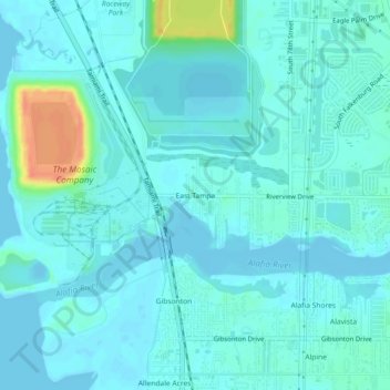
East Tampa topographic map
Interactive map
Click on the map to display elevation.
About this map
Name: East Tampa topographic map, elevation, terrain.
Average elevation: 8 m
Minimum elevation: -1 m
Maximum elevation: 46 m
Other topographic maps
Click on a map to view its topography, its elevation and its terrain.
Tampa
United States > Florida > Hillsborough County
Tampa is characterized by a predominantly flat topography, with an average elevation around 16 to 49 feet (5 to 15 meters) above sea level. The terrain is marked by low-lying areas and gentle slopes, with the highest points in the vicinity reaching approximately 62 feet (19 meters). This landscape is…
Average elevation: 11 m
Apollo Beach
United States > Florida > Hillsborough County
The history of Apollo Beach started in 1923 on land owned by the Dickman family, then used annually for farming and grazing pasture. Much of the land was mangrove and low-elevation and was considered uninhabitable.
Average elevation: 6 m
Apollo Beach
United States > Florida > Hillsborough County
The history of Apollo Beach started in 1923 on land owned by the Dickman family, then used annually for farming and grazing pasture. Much of the land was mangrove and low-elevation and was considered uninhabitable.
Average elevation: 6 m
Tampa
United States > Florida > Hillsborough County
Tampa is characterized by a predominantly flat topography, with an average elevation around 16 to 49 feet (5 to 15 meters) above sea level. The terrain is marked by low-lying areas and gentle slopes, with the highest points in the vicinity reaching approximately 62 feet (19 meters). This landscape is…
Average elevation: 11 m
Carrollwood
United States > Florida > Hillsborough County > Tampa
Carrollwood is located at 28.1 degrees north, 82.5 degrees west (28.0523, -82.4858). The elevation for the community is 39 feet (12 m) above sea level.
Average elevation: 16 m
Egypt Lake-Leto
United States > Florida > Hillsborough County
Egypt Lake-Leto is located in northwestern Hillsborough County at 28°0′55″N 82°30′26″W / 28.01528°N 82.50722°W / 28.01528; -82.50722 (28.015396, -82.507311), 7 miles (11 km) northwest of downtown Tampa. The elevation for the CDP is 45 feet (14 m) above sea level.
Average elevation: 15 m
Lake Frances
United States > Florida > Hillsborough County > Island Ford Lake Beach
Average elevation: 15 m