Maya topographic map
Interactive map
Click on the map to display elevation.
About this map

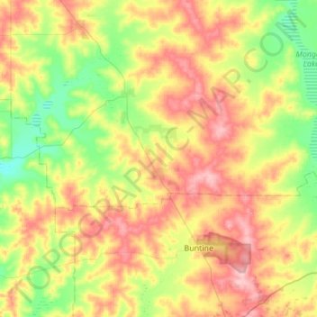
Name: Maya topographic map, elevation, terrain.
Location: Maya, Shire Of Perenjori, Western Australia, Australia (-29.92945 116.29516 -29.77424 116.84256)
Average elevation: 313 m
Minimum elevation: 262 m
Maximum elevation: 383 m
Other topographic maps
Click on a map to view its topography, its elevation and its terrain.

Perth
Australia > Western Australia > City of Perth
Perth, the capital of Western Australia, is situated on the Swan Coastal Plain, a flat expanse of sandy soil nestled between the Indian Ocean to the west and the Darling Scarp to the east. The Darling Scarp, also known as the Darling Range, is a low escarpment that extends north–south, marking a distinct…
Average elevation: 26 m

Mount Elizabeth Station
Australia > Western Australia > Mount Elizabeth Station
Average elevation: 562 m