
Sötern topographic map
Interactive map
Click on the map to display elevation.
About this map
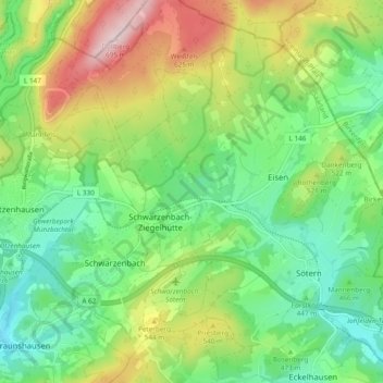
Name: Sötern topographic map, elevation, terrain.
Location: Sötern, Nohfelden, Landkreis St. Wendel, Saarland, Deutschland (49.57601 7.00625 49.63757 7.08818)
Average elevation: 481 m
Minimum elevation: 364 m
Maximum elevation: 695 m
Other topographic maps
Click on a map to view its topography, its elevation and its terrain.
Diegelsberg
Deutschland > Saarland > Nohfelden
Diegelsberg, Nohfelden, Landkreis St. Wendel, Saarland, Deutschland
Average elevation: 469 m
Türkismühle
Deutschland > Saarland > Nohfelden
Türkismühle, Nohfelden, Landkreis St. Wendel, Saarland, Deutschland
Average elevation: 413 m
Peterberg
Deutschland > Saarland > Nohfelden
Peterberg, Nohfelden, Landkreis St. Wendel, Saarland, Deutschland
Average elevation: 490 m