
Giridih topographic map
Interactive map
Click on the map to display elevation.
Giridih
Giridih is located at 24°11′N 86°18′E / 24.18°N 86.3°E / 24.18; 86.3. It has an average elevation of 289 metres (948 ft). Śrī Sammed Shikharji also known as the Parasnath Hills, located in Giridih district is the highest mountain peak in Jharkhand. It is a conical granite peak located 4,477 feet (1,365 metres) above the sea level.
About this map
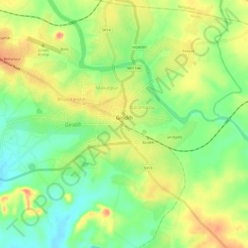
Name: Giridih topographic map, elevation, terrain.
Location: Giridih, Giridih District, Jharkhand, 815301, India (24.16335 86.26662 24.20615 86.32650)
Average elevation: 292 m
Minimum elevation: 261 m
Maximum elevation: 326 m
Other topographic maps
Click on a map to view its topography, its elevation and its terrain.