
Agona-Bipoa topographic map
Interactive map
Click on the map to display elevation.
About this map
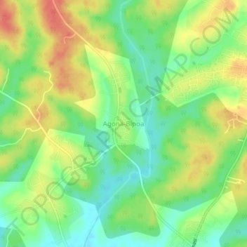
Name: Agona-Bipoa topographic map, elevation, terrain.
Location: Agona-Bipoa, Sekyere South District, Ashanti Region, Ghana (6.94383 -1.51741 6.98383 -1.47741)
Average elevation: 289 m
Minimum elevation: 262 m
Maximum elevation: 320 m
Other topographic maps
Click on a map to view its topography, its elevation and its terrain.