
Taylorsville topographic map
Interactive map
Click on the map to display elevation.
About this map
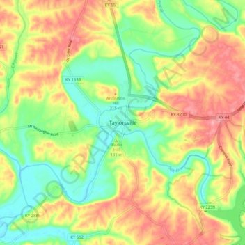
Name: Taylorsville topographic map, elevation, terrain.
Location: Taylorsville, Spencer County, Kentucky, 40071, United States (37.99173 -85.38253 38.07173 -85.30253)
Average elevation: 187 m
Minimum elevation: 139 m
Maximum elevation: 239 m
Other topographic maps
Click on a map to view its topography, its elevation and its terrain.
Elk Creek
United States > Kentucky > Spencer County > Elk Creek
Elk Creek, Spencer County, Kentucky, 40071, United States
Average elevation: 221 m