
Lignite topographic map
Click on the map to display elevation.
About this map
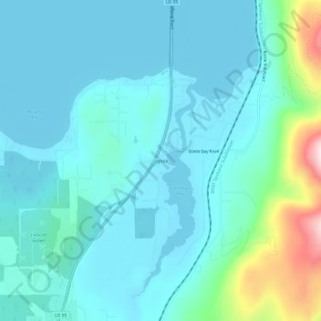
Name: Lignite topographic map, elevation, terrain.
Location: Lignite, Bonner County, Idaho, 83860, United States (48.20881 -116.56103 48.24881 -116.52103)
Average elevation: 690 m
Minimum elevation: 624 m
Maximum elevation: 1,039 m
Other topographic maps
Click on a map to view its topography, its elevation and its terrain.
Hope
United States > Idaho > Bonner County
Hope is located at 48°14′55″N 116°18′33″W / 48.24861°N 116.30917°W / 48.24861; -116.30917 (48.248728, -116.309214), at an elevation of 2,192 feet (668 m) above sea level. The city sits on the northeast shore of Lake Pend Oreille.
Average elevation: 763 m
Ponderay
United States > Idaho > Bonner County
Ponderay is located at 48°18′11″N 116°32′18″W / 48.30306°N 116.53833°W / 48.30306; -116.53833 (48.303080, -116.538292), at an elevation of 2,126 feet (648 m) above sea level. According to the United States Census Bureau, the city has a total area of 3.02 square miles (7.82 km2), of which,…
Average elevation: 652 m
Priest River
United States > Idaho > Bonner County
Priest River is located at 48°11′0″N 116°54′34″W / 48.18333°N 116.90944°W / 48.18333; -116.90944 (48.183388, -116.909555), at an elevation of 2,139 feet (652 m) above sea level.
Average elevation: 742 m
Priest River
United States > Idaho > Bonner County
Priest River is located at 48°11′0″N 116°54′34″W / 48.18333°N 116.90944°W / 48.18333; -116.90944 (48.183388, -116.909555), at an elevation of 2,139 feet (652 m) above sea level.
Average elevation: 742 m
Clark Fork
United States > Idaho > Bonner County
Clark Fork is located at 48°8′50″N 116°10′42″W / 48.14722°N 116.17833°W / 48.14722; -116.17833 (48.147180, -116.178270), at an elevation of 2,090 feet (637 m) above sea level. The town is situated on the Clark Fork River, on the eastern shores of Lake Pend Oreille. in the northern…
Average elevation: 681 m
Oldtown
United States > Idaho > Bonner County
Oldtown is located at 48°11′8″N 117°1′49″W / 48.18556°N 117.03028°W / 48.18556; -117.03028 (48.185623, -117.030158), at an elevation of 2,134 feet (650 meters).
Average elevation: 682 m