
Pointe La Rue topographic map
Interactive map
Click on the map to display elevation.
About this map
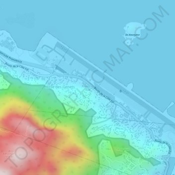
Name: Pointe La Rue topographic map, elevation, terrain.
Location: Pointe La Rue, Seychelles (-4.68017 55.50630 -4.66724 55.53455)
Average elevation: 99 m
Minimum elevation: -8 m
Maximum elevation: 542 m
Other topographic maps
Click on a map to view its topography, its elevation and its terrain.
Praslin
Seychelles > Praslin group > Baie Saint Anne District > Baie Sainte Anne
Average elevation: 25 m
Aldabra
In the early 1800s, concessions given to individuals almost destroyed the forests and tortoise habitats in many islands in Seychelles; on Aldabra Atoll, in view of its remoteness and rugged topography, only small areas of forests were cleared for agricultural operations (mostly coconut plantations) but the…
Average elevation: 1 m