Geolocate

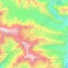
Sost topographic map

Click on the map to display elevation.

Sost

Sust or Sost (Urdu: سوست) is a village located in the Gojal, Upper Hunza in the Gilgit–Baltistan region of Pakistan. Situated at an elevation of 2,800 meters above sea level, Sost is the last Pakistani town on the Karakoram Highway before the Chinese border.

Wikipedia (CC-BY-SA 3.0)

About this map

Name: Sost topographic map, elevation, terrain.

Location: Sost, Upper Hunza Tehsil, Hunza District, Gilgit Division, Gilgit-Baltistan, Pakistan (36.64972 74.78055 36.72972 74.86055)

Average elevation: 3,369 m

Minimum elevation: 2,741 m

Maximum elevation: 4,897 m

Other topographic maps

Click on a map to view its topography, its elevation and its terrain.
Passu Glacier

Pakistan > Gilgit-Baltistan > Hunza District

Average elevation: 4,367 m

Shimshal

Pakistan > Gilgit-Baltistan > Hunza District

Average elevation: 3,364 m

Gear up for your next adventure:

Camping Shelters - Emergency and lightweight shelters for outdoor use
🧥Packable Down Jackets - Lightweight warmth that compresses small in your bag
🪢Paracord - Multi-purpose cord for camping and survival
🔋Power Banks - Portable chargers for long outdoor trips
🕶️Polarized Sunglasses - Reduces glare from snow and water when reading terrain

As an Amazon Associate, this site earns from qualifying purchases at no extra cost to you.