Geolocate

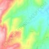
Vale Flor topographic map

Click on the map to display elevation.

About this map

Name: Vale Flor topographic map, elevation, terrain.

Location: Vale Flor, Vale Flor, Carvalhal e Pai Penela, Mêda, Guarda, Portugal (40.88829 -7.29516 40.94178 -7.24370)

Average elevation: 657 m

Minimum elevation: 484 m

Maximum elevation: 822 m

Other topographic maps

Click on a map to view its topography, its elevation and its terrain.
Gear up for your next adventure:

⛺Lightweight Tents - Compact tents for backpacking and trekking
🍳Camping Stoves - Compact stoves for outdoor cooking
🎿Telescopic Trekking Poles - Reduces knee strain on steep topographic descents
🔋Rechargeable Batteries - Eco-friendly power for headlamps and older GPS units
👖Convertible Hiking Trousers - Versatile zip-off pants for changing mountain weather conditions

As an Amazon Associate, this site earns from qualifying purchases at no extra cost to you.