Geolocate

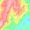
Carvalhal topographic map

Click on the map to display elevation.

About this map

Name: Carvalhal topographic map, elevation, terrain.

Location: Carvalhal, Vale Flor, Carvalhal e Pai Penela, Mêda, Guarda, Portugal (40.86358 -7.30284 40.90358 -7.26284)

Average elevation: 644 m

Minimum elevation: 503 m

Maximum elevation: 840 m

Other topographic maps

Click on a map to view its topography, its elevation and its terrain.

Gear up for your next adventure:

🕶️Glacier Goggles - Maximum protection for high-altitude snow topography
🛌Sleeping Mats - Insulated mats for comfortable outdoor sleeping
🥾Hiking Boots - Waterproof and durable boots for long-distance hiking in the UK
👕Technical Hiking Tees - Moisture-management for high-exertion climbs
🪢Paracord - Multi-purpose cord for camping and survival

As an Amazon Associate, this site earns from qualifying purchases at no extra cost to you.