
Sungai Seluang topographic map
Interactive map
Click on the map to display elevation.
About this map
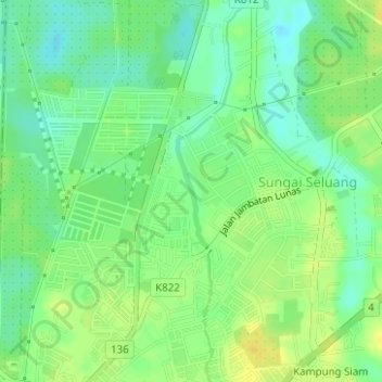
Name: Sungai Seluang topographic map, elevation, terrain.
Location: Sungai Seluang, Lunas, Kulim, Kedah, 09600, Malaysia (5.43137 100.54072 5.46240 100.54634)
Average elevation: 15 m
Minimum elevation: 4 m
Maximum elevation: 26 m
Other topographic maps
Click on a map to view its topography, its elevation and its terrain.
Kampung Siam
Kampung Siam, Lunas, Kulim, Kedah, 09600, Malaysia
Average elevation: 24 m