
Ruhango topographic map
Interactive map
Click on the map to display elevation.
About this map
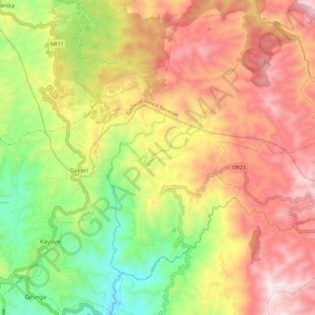
Name: Ruhango topographic map, elevation, terrain.
Location: Ruhango, Rutsiro, Western Province, Rwanda (-1.90599 29.34220 -1.80471 29.43658)
Average elevation: 2,206 m
Minimum elevation: 1,651 m
Maximum elevation: 2,741 m
Other topographic maps
Click on a map to view its topography, its elevation and its terrain.
Gihango
Rwanda > Western Province > Rutsiro
Gihango, Rutsiro, Western Province, Rwanda
Average elevation: 1,884 m