
Make a donation
Gear up for your next adventure:
As an Amazon Associate, this site earns from qualifying purchases at no extra cost to you.
Stanley topographic map
Click on the map to display elevation.
Make a donation
Gear up for your next adventure:
As an Amazon Associate, this site earns from qualifying purchases at no extra cost to you.
About this map
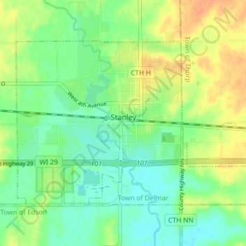
Name: Stanley topographic map, elevation, terrain.
Location: Stanley, Chippewa County, Wisconsin, 54768, United States (44.94435 -90.96398 44.97349 -90.90245)
Average elevation: 336 m
Minimum elevation: 321 m
Maximum elevation: 356 m
Make a donation
Gear up for your next adventure:
As an Amazon Associate, this site earns from qualifying purchases at no extra cost to you.
Other topographic maps
Click on a map to view its topography, its elevation and its terrain.
Northern Wisconsin State Fairgrounds
United States > Wisconsin > Chippewa County > Chippewa Falls
Average elevation: 279 m
Make a donation
Gear up for your next adventure:
As an Amazon Associate, this site earns from qualifying purchases at no extra cost to you.