
San Andres topographic map
Interactive map
Click on the map to display elevation.
About this map
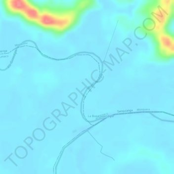
Name: San Andres topographic map, elevation, terrain.
Location: San Andres, Tumaco, Pacífico Sur, Nariño, Colombia (2.27792 -78.50289 2.28871 -78.49893)
Average elevation: 9 m
Minimum elevation: 0 m
Maximum elevation: 77 m
Other topographic maps
Click on a map to view its topography, its elevation and its terrain.