
Tumaco topographic map
Interactive map
Click on the map to display elevation.
About this map
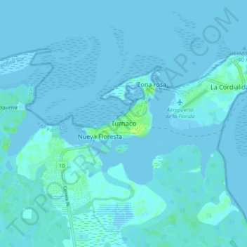
Name: Tumaco topographic map, elevation, terrain.
Location: Tumaco, Pacífico Sur, Nariño, Pacífica, Colombia (1.76776 -78.81060 1.84776 -78.73060)
Average elevation: 1 m
Minimum elevation: -3 m
Maximum elevation: 11 m
Other topographic maps
Click on a map to view its topography, its elevation and its terrain.
San Andres
San Andres, Tumaco, Pacífico Sur, Nariño, Colombia
Average elevation: 9 m