
Make a donation
Gear up for your next adventure:
As an Amazon Associate, this site earns from qualifying purchases at no extra cost to you.
Monemvasia topographic map
Click on the map to display elevation.
Make a donation
Gear up for your next adventure:
As an Amazon Associate, this site earns from qualifying purchases at no extra cost to you.
About this map
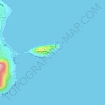
Name: Monemvasia topographic map, elevation, terrain.
Average elevation: 7 m
Minimum elevation: -2 m
Maximum elevation: 268 m
Make a donation
Gear up for your next adventure:
As an Amazon Associate, this site earns from qualifying purchases at no extra cost to you.
Other topographic maps
Click on a map to view its topography, its elevation and its terrain.
Sparta
Greece > Peloponnese, Western Greece and the Ionian > Laconia Regional Unit > Municipality of Sparta > Χαρίσιο
In 1907, the location of the sanctuary of Athena "of the Brazen House" (Χαλκίοικος, Chalkioikos) was determined to be on the acropolis immediately above the theatre. Though the actual temple is almost completely destroyed, the site has produced the longest extant archaic inscription in Laconia,…
Average elevation: 214 m
Ευρώτας
Greece > Peloponnese, Western Greece and the Ionian > Laconia Regional Unit
Logaras Spring supplies an anciently constructed catchment basin about the size of a pond, sometimes called a lake, which exits both to irrigation channels and to the Alpheios stream (not to be confused with the Alpheios river in the northwestern Peloponnese). The flow is copious except in times of drought. A…
Average elevation: 656 m
Sparta
Greece > Peloponnese, Western Greece and the Ionian > Laconia Regional Unit
Average elevation: 198 m
Municipal Unit of Faris
Greece > Peloponnese, Western Greece and the Ionian > Laconia Regional Unit
Average elevation: 732 m
Make a donation
Gear up for your next adventure:
As an Amazon Associate, this site earns from qualifying purchases at no extra cost to you.
Municipality of Sparta
Greece > Peloponnese, Western Greece and the Ionian > Laconia Regional Unit
Average elevation: 699 m