
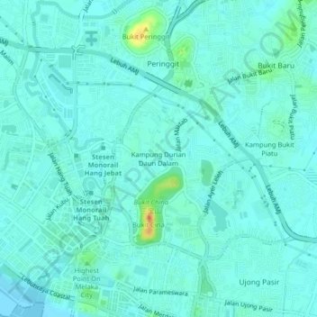
Kampung Durian Daun Dalam topographic map
Interactive map
Click on the map to display elevation.
About this map
Name: Kampung Durian Daun Dalam topographic map, elevation, terrain.
Average elevation: 8 m
Minimum elevation: 0 m
Maximum elevation: 44 m
Other topographic maps
Click on a map to view its topography, its elevation and its terrain.
Kampung Ketek
Malaysia > Malacca > Malacca City
Kampung Ketek, Malacca City, Central Malacca, Malacca, 75100, Malaysia
Average elevation: 5 m
Kampung Pengkalan Rama Tengah
Malaysia > Malacca > Malacca City
Kampung Pengkalan Rama Tengah, Malacca City, Central Malacca, Malacca, 75700, Malaysia
Average elevation: 7 m
Tanjung Ketapang
Malaysia > Malacca > Malacca City
Tanjung Ketapang, Malacca City, Central Malacca, Malacca, Malaysia
Average elevation: 3 m
Kampung Morten
Malaysia > Malacca > Malacca City
Kampung Morten, Malacca City, Central Malacca, Malacca, Malaysia
Average elevation: 7 m
A Famosa Fortress
Malaysia > Malacca > Malacca City > Kampung Ketek
A Famosa Fortress, Fort Terrace, Bandar Hilir, Kampung Ketek, Malacca City, Central Malacca, Malacca, 75000, Malaysia
Average elevation: 6 m
Bukit Cina
Malaysia > Malacca > Malacca City > Kampung Durian Daun Dalam
Bukit Cina, Kampung Durian Daun Dalam, Malacca City, Central Malacca, Malacca, Malaysia
Average elevation: 8 m
Kampung Bukit Piatu
Malaysia > Malacca > Malacca City
Kampung Bukit Piatu, Malacca City, Central Malacca, Malacca, 75150, Malaysia
Average elevation: 7 m
Taman TMU Park
Malaysia > Malacca > Malacca City
Taman TMU Park, Tanjung Minyak, Malacca City, Central Malacca, Malacca, Malaysia
Average elevation: 12 m
Kampung Cheng
Malaysia > Malacca > Malacca City
Kampung Cheng, Malacca City, Central Malacca, Malacca, 76450, Malaysia
Average elevation: 11 m
Big Island
Malaysia > Malacca > Malacca City
Big Island, Malacca City, Malacca, Malaysia
Average elevation: 3 m
Sungai Umbai
Malaysia > Malacca > Malacca City
Sungai Umbai, Malacca City, Central Malacca, Malacca, Malaysia
Average elevation: 6 m
Sungai Duyong
Malaysia > Malacca > Malacca City
Sungai Duyong, Malacca City, Central Malacca, Malacca, 75050, Malaysia
Average elevation: 5 m
Kampung Morten
Malaysia > Malacca > Malacca City > Kampung Morten
Kampung Morten, Malacca City, Central Malacca, Malacca, 75700, Malaysia
Average elevation: 7 m
Kampung Bertam Malim
Malaysia > Malacca > Malacca City
Kampung Bertam Malim, Malacca City, Central Malacca, Malacca, 75250, Malaysia
Average elevation: 8 m