Kansas topographic map
Interactive map
Click on the map to display elevation.
About this map
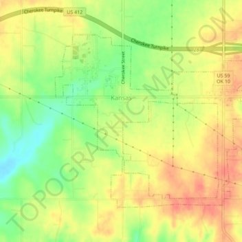
Name: Kansas topographic map, elevation, terrain.
Location: Kansas, Delaware County, Oklahoma, United States (36.18947 -94.80942 36.21406 -94.76675)
Average elevation: 354 m
Minimum elevation: 324 m
Maximum elevation: 376 m
Other topographic maps
Click on a map to view its topography, its elevation and its terrain.
Twin Oaks
United States > Oklahoma > Delaware County
Twin Oaks, Delaware County, Oklahoma, United States
Average elevation: 341 m
Eucha
United States > Oklahoma > Delaware County > Eucha
Eucha, Delaware County, Oklahoma, United States
Average elevation: 312 m
Jay
United States > Oklahoma > Delaware County > Jay
Jay, Delaware County, Oklahoma, United States
Average elevation: 306 m
Colcord
United States > Oklahoma > Delaware County > Colcord
Colcord, Delaware County, Oklahoma, United States
Average elevation: 347 m