
Macedonia topographic map
Click on the map to display elevation.
About this map
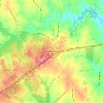
Name: Macedonia topographic map, elevation, terrain.
Location: Macedonia, Cherokee County, South Carolina, United States (35.05265 -81.78192 35.09265 -81.74192)
Average elevation: 250 m
Minimum elevation: 200 m
Maximum elevation: 293 m
Other topographic maps
Click on a map to view its topography, its elevation and its terrain.
Cowpens National Battlefield
United States > South Carolina > Cherokee County
Average elevation: 286 m
Blacksburg
United States > South Carolina > Cherokee County
Whitaker Mountain is partially in the northern corner of the town, with a summit elevation outside the town limits of approximately 1,169 ft (356 m).
Average elevation: 228 m
Blacksburg
United States > South Carolina > Cherokee County
Whitaker Mountain is partially in the northern corner of the town, with a summit elevation outside the town limits of approximately 1,169 ft (356 m).
Average elevation: 228 m