
Huedin topographic map
Click on the map to display elevation.
About this map
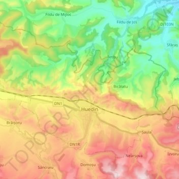
Name: Huedin topographic map, elevation, terrain.
Location: Huedin, Cluj, Romania (46.83577 22.93251 46.91896 23.09238)
Average elevation: 511 m
Minimum elevation: 326 m
Maximum elevation: 743 m
Other topographic maps
Click on a map to view its topography, its elevation and its terrain.