
Gahini topographic map
Interactive map
Click on the map to display elevation.
About this map
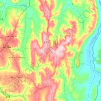
Name: Gahini topographic map, elevation, terrain.
Location: Gahini, Kayonza District, Eastern Province, Rwanda (-1.87668 30.46804 -1.73190 30.62658)
Average elevation: 1,490 m
Minimum elevation: 1,298 m
Maximum elevation: 1,739 m
Other topographic maps
Click on a map to view its topography, its elevation and its terrain.
Rukara
Rwanda > Eastern Province > Kayonza District
Rukara, Kayonza District, Eastern Province, Rwanda
Average elevation: 1,591 m